

The sun peeks over the eastern ridge to my left as I slumber, awakening me from this dream about this girl, and she's wearing, uh, and... Oh never mind. Anyway, though now wide awake, I lay about lazily for a while just enjoying the view out my windows as the sun creeps higher over that there ridge, waiting for it to warm the morning air enough to venture outside. Soon enough, I figure I better get things going so I carefully sit up, open the door, and hop on out.
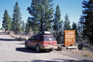 I clean up, and pack up, then head up out of my little
retreat, back to the road into Lava Beds NM. After 5 minutes I cross over into
the monument where I stop briefly to get a shot of me at the sign so indicating
(to prove I'm not just making this all up of course). Literally around the
bend is the first "attraction", Mammoth Crater and Hidden Valley.
I park and get out to walk the few steps up the trail to the overlook of Mammoth Crater, which turns out to be this very large crater. (What else?) Interesting but not spectacular. I take a few of course, then proceed across the road to the slightly longer path to Hidden Valley. And it is aptly named. After about 50 yards, this valley just opens up before me, spreading out to the east away from my vantage point, it's steep valley walls obviously formed from a lava flow, whose charcoal-colored walls are streaked with traces of variously colored minerals. Pretty cool looking actually and I am glad I 'took the chance" to stop and check it out.
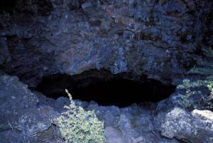 On the way again, downhill now, I almost blow by the next
"tour stop". Backing up and pulling into the little parking area, I see that
this is an unmarked (on my maps anyway) ice cave, Heppe Ice Cave. Now the hike
to this is a bit longer, 1/2 mile, but I figure, "What the heck?!" Grabbing a
couple of light sticks and armed with my trusty little keychain light (and
camera with flash), I set out. The going is easy as the path is smooth and
fairly level, though it does seem to rise gradually as it wends toward the ice
cave. Off in the distance I can all of a sudden see this rather large looking
lake. "What's that doing in the middle of the desert?", which is exactly where
we are. I'll have to find out later as I yet have no guides to the area.
Then I come to the ice cave, or rather the entrance, which is a crater-like depression in the ground where the lava tube that formed the cave has collapsed and opened to the outside world. The path descends steeply now into the bowels, the entrance oval in shape. I pick my way carefully around the large blocks of frozen lava that have chunked off from the ceiling above. Immediately, the temperature chills considerably as I cross from the glaring, sun-filled world into the gloomy interior of the cave.
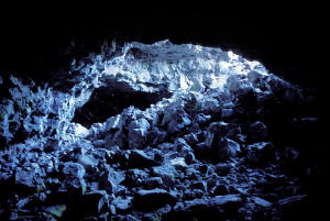 As my eyes adjust to the dimness I can see that the trail
take a couple of switchbacks down, then heads straight ahead. Marching onwards, I can
now see a cylindrical white object about 30 yards in front. The way is not
totally black because the cave opens to the outside world again what looks to be
about 50-60 yards from my vantage. Once off the switchbacks there is hardly a
trail to follow so I work my way carefully over to the object, stepping
carefully on the rocks and boulders, making sure I have steady footing before
proceeding. I come to the object and see that it's a cave register (according to
the sign). I open it and, among others, see an entry for George Bush, of
Washington DC, who wrote the comment, "I've been hiding in these caves ever
since I turned off the water". I chuckle, add my name and home to the list, and
move on.
The way heads up now towards the light, but there is absolutely no path. Climbing carefully I come to the "top" and can now either descend to the right, into more darkness, or continue up to my left to the sunlight. I choose darkness. Working my way down, the cave flattens and starts to narrow and I have to start ducking to keep from hitting my head. I shine my feeble keychain light ahead and can just barely make out that this is dead end so I turn around to see from whence I came, and because It looks like a nice little view, I mount the flash to my camera and take a couple of shots. it will be interesting to see what comes out.
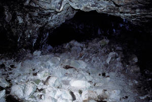 Retracing my steps I veer to the right and scramble up to the
other "entrance". Coming out into the bright day again, I can see that there is
no going out this way as the rim, though only maybe 25 feet over my head, is a
vertical and technical climb to get there. Bummer. So I head back into the
darkness and work my way back to the original entrance, emerging again into the
sunny and warm day. I didn't see any ice in this cave, but there has been a
drought this summer in Oregon and this part of California so maybe that's why.
Back in the truck and back on the road I quickly come down to the main road and turn right towards the visitor center. I pull over to a viewpoint on the left and get out to enjoy the view of the desert and grassland terrain punctuated by buttes and cinder cones, including one (Schonchin Butte) that rises dramatically right in front with a fire lookout tower on top. Off in the distance is that lake again that according to the sign turns out to be Tule Lake, a wildlife refuge and a major stop on the Pacific Flyway. The air is warm (high seventies) and I linger for just a bit enjoying the view.
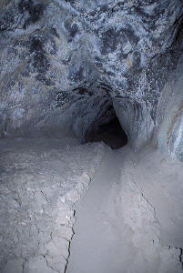 But onwards to the visitor center. At the visitor center is a
loop road from which 21 caves can be entered and explored. I find out that
these caves are all portions of lava tubes, which are formed when the outer
layers of a lava flow cools first, and slows down and begins to harden. This
acts as an insulating layer and the inner lava keeps flowing hot and fluid until
the source exhausts itself. What is left behind are lava tubes that can end up
being stacked on top of one another if there are subsequent flows along the same
path. Lava Beds has over 300 of these lava tube caves and in some, water that
enters is "trapped" as ice because lava is such a good insulator, hence the term
"ice cave".
I get the 411 from the guy at the visitor center. Thunderbolt, Sunshine, Hercules Leg and Skull Caves are the best ones to explore - the 1st three are off the loop and Skull is back down the main road a bit. So off I go to explore. I start up the loop road and come to Thunderbolt Cave first. But there are a bunch of people milling about the entrance so I drive on (I'm not in a sharing mood). Halfway around the loop is Sunshine, and with no other cars in sight I park, gather my lights and camera stuff, and head across the road to the entrance.
There a series of steps lead steeply down and to the right into the entrance to Sunshine Cave. Descending at a slight angle is a long tunnel in front of me with no end in sight. I walk in and turn on my flashlight. The floor is smooth and you can see the ripples left by the passing flow. As I get farther in, the tube narrows down so that as I walk I hold my hand up above and in front of my forehead to act as an early warning system of any sudden height reductions. It works most of the time. Ouch! I can see some light up ahead, rather bright actually, so I walk carefully along towards it.
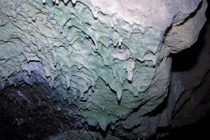 The long dark tunnel opens up into a grotto with a shaft of
sunlight punching through a hole above. Very bright. Looking up at the roof of
the grotto - inches from my head - I see patches of gray separated by borders of
white, as if it was a rock terraced patio, upside down. Little "ropes" of
solidified lava drip down into tiny, rounded stalactites (only an inch or two
long) run along everywhere above, adding to the feeling of great heat present
long, long ago.
The tunnel now heads sharply to the right, across a little catwalk, then plunges down and into darkness. A short bit ahead it splits into two narrow passages, one of which you can walk through, at best, crouched over, but more realistically only by duck waddling. This is where I turn back.
Back to the truck and the road. Around the loop to the next cave, which is Hercules Leg, a rather long one at an official length of 1948'. Alighting from the truck and walking up to the entrance I can see that this is a significantly larger cave. I enter and am in a very large chamber that seems to soar over my head. No early warning system needed here. I walk in and soon the entrance is but a faint bright spot far behind me. The tunnel narrows some, yet remains large enough to not need an EWS. I am now at a point where, if I step over to the side a bit, I can see no light coming into the cave at all. I turn off my flashlight and let my eyes adjust to the very near total darkness, It is dark. Very dark. I try waving my hand in front of my face and amazingly I can sense, more than see, it pass back and forth before me. It's as if a shadowy, fleeting presence flits in and out of my little universe. It's almost bizarre. To test that it's not just totally my imagination, I dangle the flashlight from its lanyard in front of my face and sure enough can "see" it too. Fascinating! No color sensing. All rod action (Or is it cone?), and just barely at that.
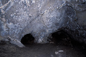 I move back out to the middle and walk toward the faint light
source up ahead. Just before I reach it - another portal to the outside - the
tunnel branches. The right one is much smaller and would require me to stoop
over severely to pass through, so guess what? I take the left branch, which
although the ceiling of the cave hovers just above, still allows me to walk,
carefully, without bending over. I come up to the window to the outside, then
move on down. As I do, my eyes kind of go haywire as they adjust again to the
inky darkness. I see pulsing concentric circles of light that grow from the
center, like ripples in a pond from a dropped pebble. Whoa! What is that all
about?
Time to move on. I hike back out to the truck and the glare of day. I figure I traversed only maybe half of it before turning back, and passed up several side tunnels that branched off. Maybe next time I will be able to spend the whole day here and give Hercules and the other caves a better exploration. One last cave to check out before I head towards Crater Lake though, Skull Cave. This has an ice floor way down at the bottom and it is one of the largest ones in the monument.
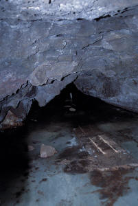 So I head north again and in about a mile or so I take the
turnoff towards it. I park, gather my spelunking gear and march down to the
entrance. Once in, I glance up and can barely see the top as this sucker is
huge! Cavernous even. Right at the mouth though I can see that the surface is
speckled with dark green and white, showing fully the former plasticity of the
lava. The path, which is paved, is tight against the right side of the tube, and
I follow it into the rather chilly interior. After rising over some boulders, a
metal staircase descends very steeply down to the ice floor below.
Unfortunately, the ice floor is sealed off to allow recovery from too many
visitors and I am able to view only through a series of bars. According to the
sign, the ice is an important source of water for the local, cave-living fauna.
So stay off!
Ok. No more darkness. Time to enjoy the light of day for the duration. Driving along, heading north, I pass over a lava field that holds prime examples of the two major types of lava: pahoehoe (smooth and ropy) and aa (rough and chunky) - kind of like peanut butter? I stop at an overlook above the field and take some shots. Continuing on I pass Tule Lake on my right side. There are but a few birds present, some herons and some ducks, but I would have to pass through in the spring or the fall to see the huge (and I mean huge) flocks that stop over here on their migrations. Past Tule Lake I am back into civilization and pass through various small farming towns.
Now this is the area that had the water cut off this spring - very controversial - and I wonder if I will see any evidence of that. Sure enough, I do. I spot various signs with messages or statements reflecting the local sentiment. "President Bush and American agencies has betrayed rural America!", says one. "Federally created disaster area" says another. I pass by one field lushly green with hay or alfalfa or something grassy, then another bare and brown. I had read that some farmers had wells to draw from while others didn't and I guess I am seeing that. I can see some irrigation ditches full of water and others bone dry. I pass a building in Klamath Falls with a sign saying something about aid and farmers and relief and I can imagine how hard hit this area was by the decision. Now a little editorial. I don't disagree with the decision to turn off the water, but I do disagree with the suddenness and with no aid to help cushion the blow; at least from what I know of things. But the bottom line is that there are limits on what you can and should do in a particular environment and driving through here I can see that without irrigation this would be barely above a desert, so...
Enough of that. At Klamath Falls I pick up Rt. 97 and follow it as it runs up the east side of Upper Klamath Lake, a broad and blue body of water, mountains filling the background behind it for a very pretty view. I pull off to get some gas and then I remember. In Oregon, you're not allowed to pump your own gas; it's all full serve. How strange! Filled up now I bear left onto Rt. 62 for the final leg to Crater Lake. I reach the park entrance at about 6; enough time to drive up to Rim Drive and catch the setting sun's warm colors on the water and crater walls. So up I go.
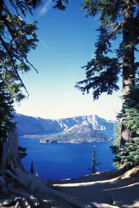 I briefly consider trying to get a room at the old,
historical lodge, but am put off by the masses of people milling about. Instead
I concentrate on capturing the evening essence of the magnificent views of the
lake and crater rim now on display. So I drive around on the west side stopping
at all the turnouts and viewpoints to shoot picture after picture. Tremendous
and inspiring. The deep blue of the lake, ringed by the multi-colored walls of
the ancient volcano's caldera, is a wonderful sight to behold. The wind has
picked up, blowing from the west, and my ventures out of the truck are just long
enough to capture that particular view, then back inside. It's over 7000' up
here and the temperature has dropped considerably.
Back down the mountain I stop at Mazama where there is more lodging and a campground. I had been debating on whether to camp or motel it and had decided that it was a motel for me tonight, so I walk into the store (where lodging requests are handled) and asked for a room. "Oh, I'm sorry. We just filled up a few minutes ago." What!? I was stunned (for some stupid reason). "It's past Labor Day for goodness sakes!" Oh well. I then considered getting a campsite, of which there were plenty available, but when I read that bear precautions had to be taken I said, "Screw it!". Too much trouble.
So back down Rt. 62 to look for lodging for the evening. Not too far outside the park I saw a sign for "Wilson's Cabins with Kitchenettes". Perfect. I pull in, ask for a cabin, and am escorted by Wilson himself to cabin #2. It was rustic to say the least, with a pilotless propane stove and freestanding oil-fired stove for heat. But for $49 it was more than enough. Plus I am able to heat up some food from the cooler for dinner, which I do. By now it's dark and yes, there is electricity, so I relax and read for a while before heading to bed.
Tomorrow, the caldera of Crater Lake and the rest of Rim Drive, then on to Newberry NM.
'Night!