

Well, it’s official. I have explored in the new Explorer! I have set up camp just off a dirt road off a dirt road off a scenic backway and the red beast is dirty, dusty, and now officially broken in. I am just south of Lava Beds NM in the Shasta-Trinity NF getting ready to bed down (Get it?) for the night surrounded by nothing but quiet desert beauty and a sky above about to be filled with a bazillion stars. It is warm. It is calm. It is peaceful. I am content.
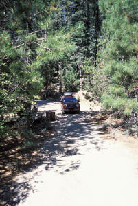 The “day” starts pretty early for me. After settling down
last night around 1 am or so, I am awakened by the sound of an engine around 4.
I look out the window and see a vehicle pull up and a shadowy form run from
the “site” next door to greet it. They take off to who knows where and the quiet
of the night soon returns. It takes me a while but I soon enough drift back to
sleep muttering to myself, “Don’t they know I’m on vacation?”
I awake again, for good, at about 9 to the sounds of activity next door. I peek out and see 2 guys in full camos going about doing something. Now, I have nothing against the armed forces and nothing against anyone’s fashion tastes, but I have to admit that I get a little concerned when I see grown men running around in the woods dressed as if they were part of our national defense forces – and they aren’t. So I keep a low profile and watch from the “safety” and obscurity of inside the Explorer. I soon realize that they are packing up to leave so I figure I’ll just wait until they are gone before venturing out to start my day.
Finally, they leave. I leap out of my bedding to go outside and greet the new (to me) day and immediately “discover” a difference between this Explorer and the previous one – this one has a low ceiling. Ouch! (Well, not really ouch, I guess – the roof is padded after all.) It turns out the “floor” to roof distance is a few inches less; enough so that I am unable to sit up straight as I could before. Oh well. Nothing’s perfect. I manage to bend and twist myself out the door and am embraced by a cool surge of sparkling clean, refreshingly cool air, rapidly warming from the bright, morning sun. I breathe in deeply and enjoy the “unfamiliar” tingle in my nose of clean air as my ears are serenaded by the rippling gurgles of the nearby stream (actually 5 feet in front of and down the bank from the truck). I look around at the abundant greenery, the babbling brook, the nobody around, and it sinks in: “I’m on vacation. Yayyy!”
 I gather my toiletries and towel and head down to the creek.
I strip down (Too much information? Sorry.) and proceed to give myself a very
refreshing, all over bath. The creek water is cold, but the warm rays of the sun
and lack of breeze keeps things well within tolerable levels. Soon I’m squeaky
clean and dressed in fresh clothes, ready to start the Volcano Tour. It feels so
good to start the day totally cleaned up which is why I prefer to setup camp by
myself and not in a campground. I suspect that at least some people would get
offended if I tried to “shower” in this fashion as they ate their breakfast.
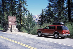
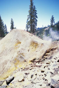
I dig out a soda from the cooler for breakfast and head back onto the paved road towards Lassen, just a few miles away. I enter through the south entrance and start up the one main road that traverses through the park, from south to north. Practically around the first bend is a small geothermal area, the Sulfur Works, with some small bubbling mud pots and a few belching fumaroles and hissing vents. The air is redolent with the “sweet” scent of hydrogen sulfide (think rotten eggs) and it makes me think of my last “big trip” 2 years ago when, among other places, I visited Yellowstone; the premier geothermal “hot spot” in the world. I snap a few pictures and continue up the road, which now starts ascending up along the side of the mountain. As the road rises I am afforded a view southward from whence I came yesterday and this morning; a vista of verdant valleys set amongst deeply forested hills and peaks. A little higher on the road I can see, in stark relief against the brightly blue sky, the jagged tooth of Brokeoff Mtn. the western remains of ancient Mt. Tehama, which formerly rose several thousand feet higher than any of the peaks present in the area today.
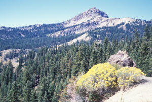 Rounding a bend as the road works up the side of Diamond
Peak, Lassen itself comes into view. It's not overly impressive, to look at, yet
it is an active volcano (last erupting in 1921), and is the highest peak
around. A short jaunt farther brings me to the parking lot for Bumpass Hell and
it is crowded! Today is Labor Day and the hordes are out and about. Fortunately,
I am able to find a parking spot with no problem (unlike 2 years ago in Glacier
NP when, on Labor Day, I had to park about a ½ mile down the hill from the
parking lot at Logan Pass). The path to Bumpass Hell itself, the largest
geothermal area west of Yellowstone, is a short 1½ mile hike and I set out
forthwith, armed only with my camera (and some extra film).
Hot tip: If you want to go to Bumpass Hell and the parking lot is too crowded (or you just want to save yourself a little bit of a walk), drive past the parking area (heading north) and pull over right next to Lake Helen. The trail is just a quick hop and a step up the hill. Had I only known...
Anyway, the trail to works it way around the side of Bumpass Mtn. gaining some elevation, then leveling out, then gaining some more, till the final leg, where it drops down rather quickly into the thermal area of Bumpass Hell. The area is named after Kendall Bumpass who had the misfortune to "discover" the area by breaking through the crust of a bubbling mud pot, scalding his leg so severely that it had to be amputated. (Bummer!) Approaching the final drop down, I am able to smell that I am getting close before being able to see anything. I joke with another guy and his grandkid that it smells like someone forgot to change their underwear. (Ewww!)
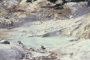
 Bumpass Hell is a seared landscape within which sits a
collection of boiling mud pots, churning hot pools, belching fumaroles and
running hot springs, at once obscured by mists of steam then hewing clearly into
view; a collection of colors and sounds unlike the surrounding area. I march
rapidly down the hill to get a close up gander. At the bottom I am struck by a
little spring running downhill from the area. The water is a dirty, chalky
white. Amazing! It cascades over a few tiny waterfalls as it heads out, and I
step down it's bank to get a closer look and to record the image with my camera.
Heading into the main area I notice that the boardwalks, used to keep people and geothermal safely separated, are in dire need of repair and replacement. What is up? There are nails popped up all over the place and some of the wood looks like, well, it's definitely seen better days. So stepping carefully, I go out to view the biggest pool, which is a pretty aquamarine color and is surrounded by mud pots all around, both quiescent and actively splattering. Walking back, carefully, along the boardwalk I then wander over towards a huge bubbling and boiling pool of hot, steam water. At times the eruptions in the pool are easily 8 ft. or more. Cool! From there I walk up the hill a bit to get a better vantage point for a few pictures of the whole area.
 I quickly ascend, then descend my way back to the truck and
once again head up the road. Just past lake Helen the road reaches it's high
point (8512') and passes the trail to the top of Lassen peak. (Some other day.)
I then begin a long gradual drop down as the road works it's way around Reading
Peak. I take a quick tour of the Summit Lake area (7000') and then back towards
my way to the Northwest Entrance. From summit lake I keep dropping down where
off to my left is the so-called Devastated Area. This is where Lassen's last
eruption mostly went and it wasn't until the 1950's that growth of any kind
returned. Today there are some trees of significance, but as I drive by I clearly
see where the flows of mud, ash, and lava came down almost 90 years ago.
I pass Hot Rock, a 300 ton boulder that was formerly part of the lava dome created from the 1915 eruption, was swept slid down the hill several miles during a combined avalanche and mudflow. It was still sizzling hot several days later, and probably took several months to cool completely. At the bottom of the long hill is the Loomis Museum, which also serves as the park headquarters and visitors center. Also here is small Lake Mazanita where one can go swimming, or boating, or just sit and admire the view of the ducks and other wildlife that calls it home (temporary or otherwise). I stop only briefly before heading out of the park, northwards to Lava Beds NM.
 Driving along Rt. 89 is pleasant enough. I'm in the
mountains, but the terrain is more rolling than rugged, so I'm able to make good
time as I drive along through the forests and fields, passing through tiny
clusters of building not numerous enough to be labeled even as settlements. Just
as the road bends west for an almost straight shot towards I-5 Mt. Shasta rears
it proud, snow-mantled peak into view. Wow! That sucker is tall! I now though
have to get off the main road, as I had decided earlier to take the back way
into the monument, so I turn onto the road towards Medicine Lake, in
Shasta-Trinity NF, about 25 miles away.
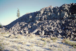
Here I start gaining elevation again and I soon have a good view of the area, including back towards Mt. Shasta whose flanks are starting to glow softly as the sun moves lower in the western sky. I pass fields of jumbled chunks of dark brown-black lava, laid down from prehistoric volcanic events, where only a few scrawny trees are able to gain a foothold and derive enough sustenance from the meager offerings of the bare soil to grow at all. I am alone on the road, which is paved and in fairly good shape, and I ride along easily, heading towards the days destination in Lava Beds.
 I make a pit stop at Medicine Lake and, relieved,
continue on, anticipating today's journey's end. Just past Medicine Lake, to my
left, I see what looks to be an extensive lava flow, rising over 50 ft. from the
adjoining meadows. I pull over to make a closer inspection. After a hike of a
couple hundred yards, I come right up to the edifice and see that it is even
higher than I thought. The sides are as if some giant child had stacked blocks
of lava, of all sizes, many of them huge, up against the side the plateau above.
I am tempted to climb up to the top to see what's what, and even start up, but
then I think, "What if they're not stable?" "And if I slip and fall? "And if no
one is around?" (There wasn't.) So I wus out. Oh well. The sun, sitting very low
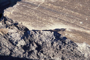
in the sky now, glints off the sharp, angular edges of the rocks, as you look
towards it, making them look almost metallic. There are many interesting shapes
and textures among the many jumbled heaps scattered about the ground at the
bottom, and I bend down low to catch the effects with my camera. While on bended
knee I remark to myself that, though rough and tough looking, the ground
actually feels, well, almost soft. Getting up I reach back down to grab a
handful of the pumice gray colored soil and find that it is, well, pumice! The
"dirt" all around, at least the very top layer, is pumice. Neat! The particles
range from fines to little cobbles, but it is all of course very light,
and seemingly resilient when impressed upon (by for instance a knee). I collect
a handful of the larger pieces as souvenirs (I know. I know. Bad tourist,
but...) and head back to the truck and drive on.
 The road runs out of pavement, but is pretty good quality
graded gravel. I had left it kind of open as to where I would stop for the
night. At the campground in the monument? At one of the campgrounds in the
Shasta-Trinity? No motels nearby so... Feeling just a touch misanthropic I
finally decide to set up my own campsite again so I head east along one of the
side roads coming into the "main" road. After a few forks and turns I see a
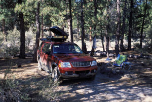
little, secluded clearing so I "jump" off road towards it. I park, get out, and
survey the scene. It's obvious that I am not the first passer by here as there
is a campfire rock ring. The area is a flat, non-rocky desert meadow with thin
standing pine and pinyon trees. The sun has set behind an intervening mountain,
yet there is still plenty of light and the evening air is warm with a pleasant
breeze just barely blowing. This will do!
I unpack relaxing (beach chair and side tables) and dinner stuff, pop open a Corona, and get the new stove/grill put together and fired up. I cook some steaks I had marinating in the cooler, and along with some fried rice have a very tasty meal by lantern light - and no mosquitoes! (Though something got to my "slipper" shod, sock-clad feet - I was itching for days!). I read by both lantern light and the reflections of the full moon that hovers brightly just over the ridge to the east of me. And I write, and I just relax. While relieving myself one last time before heading for the truck for a much needed sleep, a bat flits by close to the ground, chasing down something for dinner I suppose. It's been a long day, but a very enjoyable one. I saw some marvelous sights. Took some great (I hope) pictures. Got a little exercise. And found a wonderful spot to spend my second night, On the Road!
Good night!