
Once again I was awakened by the rumbling sound of a diesel starting up - at 5am. This was soon joined by the rest of the motel's occupants all getting ready and into their noisy vehicles by 7. When I looked out the window the parking lot was bare; the same lot that was nearly full when I pulled in last night at about 8:30pm. I guess those people are the type who say, "Let's get a move on Maude, we're burning daylight!", unlike normal people like myself who believes strongly that the day starts whenever you get up (at a "normal" hour). Oh well, I'm almost used to it by now. It made me realize the advantage of getting a room on the 2nd floor - no noisy engine a mere 5' from your window!
 Since I'm already gassed up I make a quick stop at the McDonalds to get breakfast. As I'm getting back into the Explorer I notice
that there's a carwash across the street. "Hmmm. It's really dirty from White Sands... But it's just going to get dirty again and..." But then I think
about if I end up camping and need to get into the box on top, well, that's going to be really messy the way it is so, "I'll do it!".
So I go and spend $3 to clean it off and it does indeed look a lot better. Then I try to go through town to the next exit where there's a Love's for some provisions and end up going on a gravel and dirt road which just coats the back of the truck right up again! (Yeah, yeah, I know. "What a moron!") Anyway I get what I need at Love's and finally hit the road by 11. By then it's in the high 40's and mostly sunny and clear above. Should be a great day!
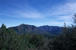 My destination for today is Chiricahua NM in the Coronado NF, just over the border in Arizona. I'm going to go in the back way,
which will take up to over 8000' to get to the monument on the eastern side of the national forest. The monument is named after the Chiricahua Apaches
who for many years hid out in the area from the US army as they tried to round up and place on reservations the Native American population in the
west. Two notable members of this tribe were Cochise and Geronimo.
I get off I-10 at San Simon and start heading south towards Portal. After about 5 miles the road goes from paved to gravel. Nonetheless, it's in great shape and I'm able to keep up a good pace. Eventually though it starts to degrade some, becoming narrow, more "washboardy", and more curvy. By the time I get to the mountains and the road starts working it's way up, I'm lucky if I can go 30mph. But no matter, as it's now almost 60°, and very quickly I'm in a forest of junipers and pines that get taller and bigger and more dense as I quickly ascend up the eastern flank of the (I think) Pendregosa Mtns.
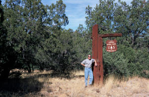
About 20 miles from the freeway I pass through the very tiny settlement of Paradise and enter the Coronado National Forest. To commemorate, I stop and take a picture of me standing by the sign. From there the road, FS 42B, quickly switchbacks up the side of the mountain until it intersects FS 42 coming up from the southeast. By now I'm over 6400' up, and though the temperature still remains in the mid-fifties, I've already driven through some well-tracked (and melting) patches of snow on the unexposed portions of the road. When I was stopped to get a picture of a vista, I heard this horn. "Huh!" I looked down and this blue Subaru was honking, "Honk, honk, honk, honk...!" every time he rounded a turn. So much for solitude!
I turn right, staying on 42B, heading towards the monument. A mile or so in is the turnoff for Rustler Park, which is up the ridgeline towards Fry's Peak. Feeling a bit adventurous I hang a left and start up towards the park on FS 42D. Since I'm still ascending the patches of snow are thicker and longer, but since it's so warm today (and probably has been since it last snowed) I'm pretty much driving on bare ground when I keep in the tracks from previous excursionists. (Of course I don't always keep in the tracks!). In a few miles I get to Rustlers Park which looks to be a big picnicking, camping, and hiking spot as there is a big campground, a large picnic area, and several trailheads here. It's all deserted at the moment though.
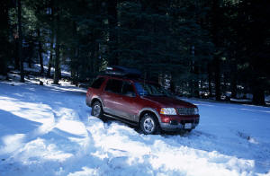 I drive through to see how far up I can get. By now if the road is not exposed to the sun it is covered
in snow, though still fairly well tracked. I head up a little spur towards the empty ranger station because the snow looks like fun. I go up to the
end of the tracks and plow a couple more feet in before stopping so I don't get stuck. Backing back down a bit I spin it hard to turn onto the road
that curves around the front, slipping and sliding the whole way. Woohoo! Then it's back onto the road up the hill. After passing through a narrow
cattle guard it gets serious. The way is still tracked, but the road goes up and curves and there's only a few, small patches of bare ground showing
through. I pull up a ways, where the wheels start to spin ("Yes, I'm in 4wd, Low!") and stop to get out and take a look. I hike up the road a bit to
check it out. After mulling it over I decide that it's time to head back down. While I probably could make it, since I'm by myself it's probably
better that I don't make the attempt. And to be honest, since Ford is now putting "All Season" and not "All Terrain" tires on the Explorers, I really
don't feel that I have the "bite" that I used to have. Bastards!
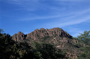 So back down I go. I have some great views looking east and north as I descend to 42B. I figure I made it
as high as 8400' before turning around, and by the time I did, the temp had dropped to 49°. Cool! (Literally) Halfway out is FS 357 which heads down a
bit to Barton Park and beyond to Rattlesnake Canyon & Peak, skirting around on the north side of the slope. Let's see how that looks.
Initially, I head up a small hill that's all muddy and rutted from the melting snow and previous vehicles. I slip and slide a bit up the incline until it levels out. As it curves around to the north side, the road is completely snow covered, but well tracked - and mostly level. I stop and put it in low before continuing. Progress is pretty easy though I slide a lot within the tracks. Until I come to the first significant downhill.
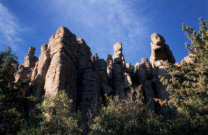 I just start to go down and then stop to see how it looks. Well, it looks ok - not too steep - and
looking at the topo it looks like the rest is probably similarly sloped. But before I tear on down I decide to do a little test. How easy is it to
back up hill from here. I shift into reverse and give it some gas. "spinnnnnnnnn" "What!" I try it again, "spinnnnnnnn" "Uh oh!" I ease
forward a bit then gun it in reverse. It freewheels, then grabs, and I spin my way back up the short uphill. "Ok. That's it! I'm not even going to try
this!!", so back down and out I head again. No problem getting back through to 42D where I make a left to "get the hell outta here"! That's enough
adventure for today I think!
"Hey I said that's enough adventure for today didn't I?!" Whereas I though I would be quickly out of the snow and ice - since I would be going downhill all the way - it turns out that the west side of 42B is way worse than the east side (where I came up). It's mostly snow covered - not many snow free spots - and it's icy! I suppose because I'm on the north side and there are a lot of shading trees. Anyway, I have to slow it way down or else I'm not going to be able to make the sharp turns the road takes as it works its way down, so I end up barely creeping along in 1st or 2nd, 4WD Low (low-low) for most of the way until, finally, I get low enough so that the snow has already melted. Whew! Thinking about it, I'm not sure that I could have made it coming up this way. Too much ice! It's a good thing I am going downhill on this side and not uphill. Two adventures in 1 day. Wow!
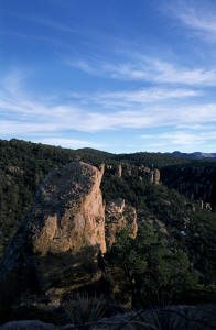 And of course I do make it down all safe and sound, and after a few miles I get to Rt. 180 and turn right
to go into Chiricahua National Monument. By this time it's almost 4pm so I don't think I'm going to be able to get in any of those hikes I was reading
about in the book my dad gave me for Xmas. I pull up to the Entrance Station and proffer my Golden Eagle Pass to the attending ranger.
"Are you going to be camping with us this evening?
"I'm not sure what I'm going to do yet. Maybe." ("Why? What'd you have in mind???")
"Well, here then. Let me give you this sheet on the campground so if you decide to stay you'll be all ready."
"Thanks!" ("Oh. I'll be ready all right!")
From there I drive up to the Visitor Center where I purchase (for only 25¢) a brief guide on the hikes available in the park. While inside I also see some pictures of what I can expect to see on the various hikes; I've already been impressed by the formations visible from the road on my way to the Visitor Center! The ranger inside suggests that I drive up to Massai Point at the end of the 8-mile scenic drive, since it's almost sunset - there are nice view looking both east and west from up there - and then decide whether or not to stay overnight on the way down. "That's exactly what I thought I would do!"
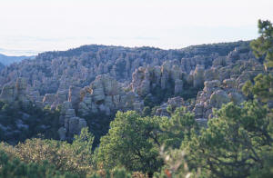 So off I go up the scenic drive. It's a somewhat narrow 2-lane road that follows the creek up Bonita
Canyon. Along the way I pass some very cool looking formations and I'm thinking that I definitely need to stay so I can go hiking tomorrow. One of the
points along the road is called Organ Pipes because the rocks there look like a huge collection of big, fat organ pipes. The setting sun is
lighting them from the side facing me so they look even cooler. Unfortunately, there's really no spot to pull over so I'm unable to get a good shot of
them. Oh well.
I get to the top and park and get out and indeed, I do have a fine, panoramic view, especially of the valleys immediately to the east and to the west, and the mountains beyond them (including where Geronimo used to hole up). There are some nice looking rocks around, and after reading a trail guide up there, I decide that I need to come up here tomorrow for some hiking, so, yes, I will be camping. Yayy!
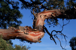 I drive back down to the campground and select a very nice site right next to the restrooms (but not too
close), with a long pull-in, which, since I'll be sleeping in my truck, is just what I'm looking for. I set up the lantern (which turns out to have a
cracked globe), and rearrange things so that my sleeping area is clear and ready for my tired body later. I have a fine dinner of a Subway sandwich,
that I had bought earlier, with some chips and a soda. Tasty! Afterwards, I set up the beach chair and my 2 little tables, grab a couple of blankets
from the truck, light my 2 fake logs, bundle up, sit down, and start writing on the laptop. "Good lord. It's only 6:45!" Could be a long night!
_750.jpg)