
As I thought, the day is quite the opposite of sunny, blue skies so I take my time getting ready to go out. Eventually though I make it outside where I encounter a brisk morning though it seems like there is no threat of any kind of precipitation. Since I gassed up when I got into town last night I throw my things in the truck for the day and head out.
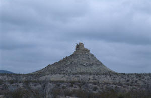 Even from down below in Study Butte the Chisos Mtns. command a
good portion of the skyline and, as I head towards them and into the park,
their tops are smothered from view by the grayish clouds that once again cover the whole sky today. Looking through The Window and into the Chisos
Basin I can see that perhaps it's a good thing I'm not staying at the lodge up there. I'm certainly glad I didn't decide to stay in the campground like the
last time I was here (about 15 years ago). Then it was sunny and warm, and quite pleasant. Not quite so nice this time around. But even as I compose
this by the side of the road I do see a brief bright spot up above where the sun is trying to make its way through the clouds. Let's hope for its
success.
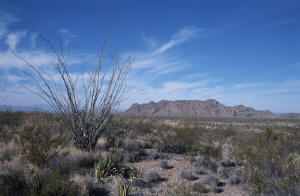
I can see that there is a light dusting of snow on the mountains, starting about halfway up, that I hadn't noticed yesterday. And not surprisingly the temperature is descending as I ascend. Already it's dropped to 34°. The desert landscape here is striking, beautiful even, though in a stark sense. And quite colorful. The purplish pods of the prickly pear, the yellows found in some of the rocks, the greens, grays, and browns of all the desert plants, the whites of the spent stalks of the yuccas and agaves, and needles of some of the cacti. A veritable rainbow, though subtle in hue. I'd love to be around when the desert here blooms as there is an abundance of vegetation, and during a good year I'm sure it's quite spectacular.
The view as you drop down from Panther Junction is of a large plain spreading out before you below with rows of ridges receding into the distance, the horizon today a blur as they meet the clouds sitting low in the sky. That's the Rio Grande down there somewhere, along with Boquillas Canyon, my destination for today. I pass by the road for Glen Spring and, looking at my map, I see that it's a possible way back if I choose not to retrace my route along Rt. 118. It would be about 25 miles of dirt road, some of it close to the river, so we shall see.
 The first stop for the day, other than those for picture taking, is the Rio Grande Overlook. Well, grande it is not. I am
actually a little disappointed. I guess it's just not what I had expected. There's really not much to see and the wind is still numbing as I look
around for... what? No biggie though, there's still plenty more to see.
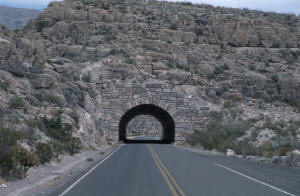
Just before I get into Rio Grande Village, and the turnoff to Boquillas Canyon, the road goes through a short tunnel cut through the ridge running across the it. I stop, get out, and take a picture of it to add to my "The Road Less Traveled" collection. Since Boquillas Canyon is my "destination" I take the turnoff to it on the left, "Boquillas Canyon 4 miles". About 2 miles in is Boquillas Crossing where you can take a short ferry (non-vehicular) across the river to the little settlement of Boquillas del Carmen, Mexico. I don't stop, but rather continue on as the road winds past among low, rugged, eroded hills, ever dropping down to the Rio Grande.
Just before the road ends there's a short drive to a little overlook of the town of Boquillas, which is perched on a series of small hills set right against the banks of the river. While taking a shot of it I nearly freeze my a.. off with the blasts of cold air tearing by where I'm standing. Brrrr! I hurry back to the shelter of the truck and quickly drive the short distance to the southeastern terminus in Big Bend NP. There's about a dozen or so vehicles (I believe that's pronounced, vee·hik·ulls in these here parts) in the parking area already, and I slide the Explorer right in amongst them. Taking care of business, I gather my gear and head onto the Boquillas Canyon Trail.
 The path takes me up a series of steps to a nice overlook of the Rio Grande as it comes up from the south
before curving eastward and into Boquillas Canyon. I get off the trail (It's ok. It's all rock here.) to get a closer, more personal view of things.
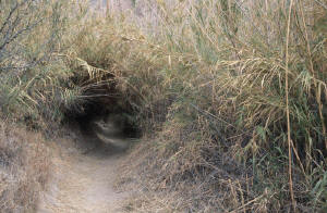
After wandering a bit I get back on the trail, which is now descending, and in no time I'm walking on the sandy floodplain of the Rio Grande. The path
scoots right through an archway cut into a thick stand of some cane-like reeds, which rustle and sing as they rub against each other in
the wind. It almost sounds like wooden wind chimes, though more muted and perhaps not quite as melodious.
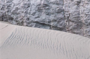
The trail goes up and down a tiny bit, the river plain narrowing as I get closer to the entrance to Boquillas Canyon. Quite a bit of sand has been trapped against the hillside, especially where there are shelves of rock and boulders. I go up to check out a couple of places, which, because they are up, are less trammeled by trail trodders. There are some of the nice, wavy patterns I always delight in seeing where sand and wind get together, and I shoot a few pictures of them. The sun has actually come out by now, sort of, partly, kind of, and adds a nice touch of warmth to the colors.
 I'm now walking on a mound of cobbles, and with the wind blowing, incessantly it seems, out of the
canyon, I stop to get out my gloves (liners actually so I can still work the camera's controls) and zip up my jacket. Brrrr, again! I'm alone on the
trail now, quite a few people have passed me heading back, and I see no one ahead of me. Solitude. Nice! The sun is now fully out, at least for a
while, and it lights up the canyon walls that rise up hundreds of feet above the river, now right in front of me. I continue on the trail, which very
soon is the only piece of land between me and the river, rushing by me in a steady brown swirl.
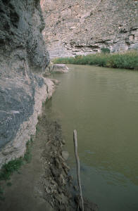 At places the river has eroded the bank and cut into the trail so others before me have "carved" new
segments up on higher ground. This requires a bit of climbing and scrambling to continue on, but nothing too serious. Eventually, too soon for my
wishes, the trail peters out into the river, and though the rocky wall looks as if I might be able to step up and continue on, for at least a short
ways, I decide to turn around and head back out. Prudent as always I am!
I take a slightly different way back, hugging the river where possible, taking a last few shots of the river as it heads into Boquillas Canyon on it's long journey to the Gulf. From across the river I am serenaded by the piercing braying of some goats being shepherded along the opposite bank. It sounds like they're in pain, but when I gain some higher ground again, and get a look at them across the way, I see that nothing seems amiss with them, and conclude that that's just the way they sound. Glad they're not in my backyard!
On the way out I stop briefly in Rio Grande Village to grab a soda, then continue on to the turnoff for the hot springs a couple of miles back on Rt. 118. A short ways in is a parking area and a sign saying, "Don't you go in there Mr. RV!", and they're not kidding! Just beyond, the road splits into 2 segments, one going each way. They are super narrow and very twisting. Even a 'burb might have some trouble getting by.
Fortunately, it's only a short shot down to the parking area. There are a few building remains in the immediate area - this used to be a small resort - and I go to check them out. Nothing special. I head across a small wooden footbridge, but stop to take a picture of it and the first of several golden Tamarisks scattered about the grounds; the sun is now fully out and it brightens everything up very nicely. Across the bridge and to the left is a relatively intact, long building where, upon looking inside, I can see some nice murals on the wall of local scenes - still bright and colorful. I'm prevented from going inside by screens, but can easily inspect the interior through the mesh place in all the many doors and windows.
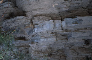 The path to the hot springs leaves the buildings behind and comes hard up against a highly stratified and eroded rock wall, light
in color. Looks like limestone. (Like I know!) At a couple of places there are some petroglyphs and I stop to take a quick look see. While peering at
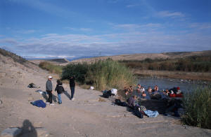
one set I see a bunch of mud swallows nests daubed to the underside of one overhang. Just beyond is the hot springs pool, a concrete pool that sits
right by the Rio Grande. There are about 8-10 people soaking in it, and bunch of others sitting around, having just been in or getting ready to go.
I'm not up for a "Jacuzzi" today so I take a picture of the scene instead. The path continues past the 'hot tub" and on to the campground at Rio
Grande Village. Heading back to the truck, I encounter a couple I crossed paths with at the canyon. "Where're we going next?", he says.
 Making it safely back up the other split segment and back to the main road I come to the turnoff for River Road. "Well, maybe I'll
just take it down to the first riverside cutoff, and then turn around and come back out. I sure don't feel like 25+ miles of who knows in what
condition 4WD road!" Mmm, hmmm. Right! Well, I keep thinking like that for the next one and the next one until I'm so far in that I might as well keep
going. A couple of trucks pass me going the other way - Including one guy whom I don't think feels too comfortable out here cause he almost scrapes me
rather than going just a tiny, little bit up the side of the road as he goes by - like I way am, pulled over so he can pass with no problem - and
after a bit I'm all alone out here. (Oh my!) The road is for the most part in pretty good shape and I make good progress, especially when it finally
turns way from the river and heads for Glen Springs and Rt. 118.
But, the 2 shortest ways back, according to the map, are nowhere to be found, and I end up going the "long way". I actually turn around twice just in case I missed the forks in the road, but they are nowhere to be found. Mystery! Even at the end an on-the-map shorter way is missing. Oh well. Just before I get to Glen Springs I spy a solitary tent with one of those aluminum, strap lawn chairs beside it, but no vehicle or people. There are quite a few "backcountry" campsites and I guess this is one of them. A couple of minutes later though I see some headlights coming my way, and a short time later a couple in a Tahoe pass me. Must be theirs. That's what I should be doing - camping - but I like my heat and CNN Headline News. (Wimp!)
 Finally, I hit the turnoff to Pine Canyon and start descending again to Rt. 118. I am disappointed to see that I just missed the
setting sun striking the ridges and canyons spread out before me. This is definitely a spot to be when the sun is getting ready to set. Late as I am,
and cloudy as it still is, I can still make out the reddish tint added to the colors of the rocks in the distance. I am sure it must be very, very
pretty at the right time and conditions. I press on.
Coming up to Panther Junction I see more colors. Up above, fingers of clouds, outstretched over the Chisos Mtns as if to scoop them up in a giant handful, are lit underneath with a rosy-orange glow from the sun setting in the west, hidden from my view on their eastern side. Wonderful. And then as I skirt the Chisos, and they no longer block the horizon, a beautiful sunset has been arranged for those who care to look. Again I'm about 10-15 minutes from prime time so I decide to just enjoy the colorful view as I head back, on the final leg of the day, for Study Butte.
I make it down the mountain road safely, after getting stuck behind someone who was going even slower than the 45 speed limit - the whole way down! Oh well, I wasn't in any rush. I gas up back at the store next to the motel and decide to do some laundry - so I can continue to wear my new, long-sleeve shirts again on this trip! Waiting for the clothes to be washed and dried gives me an opportunity to finish writing this all up and after ordering some dinner to go I finally retire to my room for the evening. Planning for tomorrow, which is supposed to be sunny and clear, I figure I'll take the scenic road down to Castolon and Santa Elena Canyon, than back up to Study Butte and onto the nearby Terlingua Ghost Town, and from there? Well, I'm thinking maybe I'll just head up towards Guadalupe Mtns. NP after that. Its a couple of hundred miles from here so it'll take a while to get up there. If the weather is cooperative perhaps I'll camp out in the truck overnight then head up to McKittrick Canyon on Friday - it's supposed to be spectacular. If not, I may have to head up to Carlsbad for a motel 'cause I don't think there's a whole lot up there, accommodation-wise. We'll see.
%20N,1,25_750.jpg)
%20C,1,25_750.jpg)
%20C,1,45_750.jpg)
_750.jpg)