
Some stinking loud diesel truck fired up at 5 am and woke my a--, I mean, restfully sleeping self up. Jeesh! Doesn't anyone sleep to a normal hour?! Being in a strange place and still suffering from my "sickness", I slept fitfully at best until I finally got up about 8:30. Of course my cough, the dry, hacking, now mostly non-productive one started back up again too. I don't know what it is about me traveling and getting sick, but it seems to be happening a lot lately - this time, last Thanksgiving in Bryce, 2 years ago in Sedona. Maybe it's just during the cold season and/or staying in motels with that dry fan air (Maybe I should camp?), I don't know. I do know that I'm sick of being sick. Why can't it happen when I'm home and working (so I can make use of those sick days)?
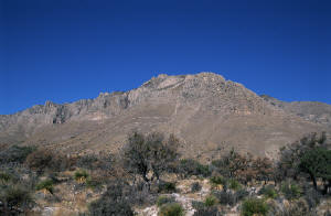 Getting out on the road I am greeted with a big, Texan, blue sky welcome. It's in the high 40's and looks to be a beautiful day! I
head north out of Van Horn onto Rt. 54 towards Guadalupe Mtns. NP. This is ranching country out here and they are huge! I pass by only a handful
during the 55 miles up to US 62. It's a nice drive though, and kind of scenic. I can see the Guadalupe Mtns. starting about 40-45 miles away. Pretty
clear today!
Rt. 54 dumps out on US 62 and it is a fine road. Unlike Rt. 54, the speed limit is 70 (65 night), the max in Texas. I get to switch time zones again - I'm now in Mountain Time, so I adjust the Explorer's clock. (One more to go!) The highest points in Texas are in the Guadalupe Mtns. and from the plain here they rise over 4000' above. After a few miles the road up and over Guadalupe pass is one of the steepest grades I've been on in a while, about 800' in 2 miles - 7½% ! Once you're on top, up over 5000', it's only a couple more miles to the Visitor Center at Pine Springs.
 I pull in the Visitor Center parking lot and head for inside. On the way though I start to read the little marker identifying and
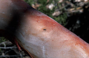
explaining about the Chihuahuan Desert flora indigenous to the Guadalupe Mountains. I finally see what the Texas Madrone looks like that I've been
hearing about (a medium-sized tree with scarlet red bark that peels off naturally, revealing a smooth, pinkish to red surface underneath). There's a
nature trail that heads off to the left, toward the ruins of the highest stagecoach stop of the old Butterfield Overland Mail, the first stagecoach
route to connect St. Louis and San Francisco - 2800 miles in 25 days! (Part of the route can be seen in Anza-Borrego Desert State Park in eastern San
Diego County, near the Salton Sea.) I start down the 1/3 mile trail, reading and learning.
 Then the sun goes behind a cloud and since it's only in the low 40's with a breeze, and I didn't bring my jacket, I start to
shiver. Dang! I button my flannel shirt, jam my hands deeper in my pockets, and continue on. "I can take this!" Fortunately, the sun's cover-up is
short-lived, and once it's back out it's warm enough to enjoy the desert plants infomercial. By the end I feel I can distinguish between the Sotol,
Agave and Yucca with complete accuracy, and spot an Alligator Juniper from 50 yards. It's well worth the walk as the placards give detailed
descriptions of a particular plant complete with usual habitat, unique and identifying characteristics, animal and human uses, and more!
 After reaching the ruins of the stagecoach stop - unfortunately there isn't a whole lot left - I hurry back to the Visitor Center
where I go through the exhibits and get some brochures and guides. Back on US 62 I head north again. Just a short skip away is the road leading to the
Frijole Ranch History Museum, a restored and preserved group of buildings built and lived in by local settlers, the first of which were erected at the
turn of the century. I'm not so interested in the history and culture as the hike I plan to take there today, Smith Spring, a 2.3 mile loop that will
take me to Manzanita and Smith Springs.
 By now it's warmed up to almost 50° though the wind is still gusting. (I passed a wind farm on a nearby
ridge on the way up, and the Guadalupe Mountains are known for some particularly fearsome blasts every spring.) I decide to go up the trail clockwise
so that I will encounter Manzanita Springs near the end (rather than the beginning). The path starts up the dry hillside, gaining elevation at a
moderate pace - this is an easy hike. I scoot down, across, and up a few washes as the trail work its way across the hillside, until it turns up to
follow the main wash up to Smith Springs. I note that there are many fine examples of the Chihuahuan Desert plant community along the whole route -
which I do my best to identify - the Sotol plant is especially well represented.
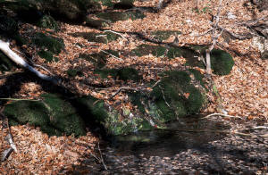
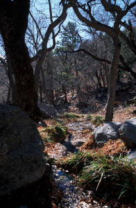
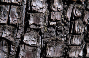
Just before you get to the high point of the trail, at Smith Spring, you enter the riparian community created by the perennial flow of water. Whereas before I was exposed to the sun and elements, here I find a cool and shady retreat plunked amidst the dry, hot, generally inhospitable desert. I stop to take some picture of the pretty rose-colored wood on a Texas Madrone. Continuing to the spring I pass a miniature cascade, the trickling sound of the water adding a soothing and pleasant harmony to the soft rustle of the leaves on the trees.
 At the spring now I say hello to a couple of fellows already sitting there on the handy native stone bench, who tell me that
they're out doing a bird count today but aren't having much luck. Hearing a bird off in the distance I ask them what it is. "That's a Western Screech
Owl." I never would have guessed that was an owl. In the daytime even! (Learn something new...) The two gentlemen depart after a few minutes and I am
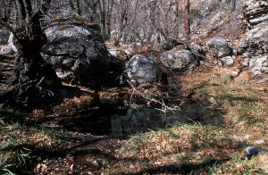
left to my own thoughts. I look around at the many trees whose branches sprout at every odd angle, at the ferns growing in bright green clumps, at the
desert plants interspersed with the woodland shrubs, at the gray limestone and dolomite boulders "placed" strategically about, at the grasses
sprouting from beneath the water at the right edge of the pool- an arrangement as artful as any professional landscape architect could produce. I rest
a spell to take in and enjoy.
 Continuing on now, downhill, the trail quickly leaves the sheltering woods behind and back into the desert scrub adorning the
hillsides. The way down on this side is a little steeper than the way up, but still moderate. In no time at all I make way it all the way down to
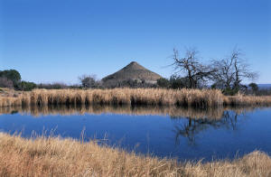
Manzanita Spring where a large pool, fringed with tall yellow grasses sits. Typically, this is an important resource for birds in the area - and those
passing through - but today there aren't many avian visitors. The rest of the trail back to the ranch is flat and paved, and only a few hundred yards
more. Back at the truck I reflect on the hike as I stow my camera gear. I'd have to say that if you're in the area then this is a must do. It's quick,
it's easy, it's historical (at the ranch), it's pretty, and it represents multiple environments found in the park. All in all I found this to be a
delightful little jaunt. Next stop is McKittrick Canyon, a renowned place among fall foliage cognoscenti.
_750_small.jpg) It's but a short drive up Rt. 62 to the turnoff to McKittrick Canyon. When I arrive at the parking lot and Visitors
Center it's already 2pm. The gates close at sunset (5:30ish) so I hastily gather my gear and set out on the trail up into the canyon. From the Visitor
Center the trail quickly descends into the stony wash that flows out from McKittrick Canyon. It's completely dry now though McKittrick Creek - the
reason for the lushness that I am soon to see in the canyon - does make it's presence known during the spring and summer. My literature tells me that
as I start to actually enter the canyon that I will see flowing waters.
It's but a short drive up Rt. 62 to the turnoff to McKittrick Canyon. When I arrive at the parking lot and Visitors
Center it's already 2pm. The gates close at sunset (5:30ish) so I hastily gather my gear and set out on the trail up into the canyon. From the Visitor
Center the trail quickly descends into the stony wash that flows out from McKittrick Canyon. It's completely dry now though McKittrick Creek - the
reason for the lushness that I am soon to see in the canyon - does make it's presence known during the spring and summer. My literature tells me that
as I start to actually enter the canyon that I will see flowing waters.
It's about a mile before entering the actual canyon and I walk quickly to ensure that I can make it in and out. After about 15-20 minutes of speed-walking I start to see puddles of water, followed by the freely flowing creek shortly thereafter.
_750.jpg)